Iran
Maps of Iran
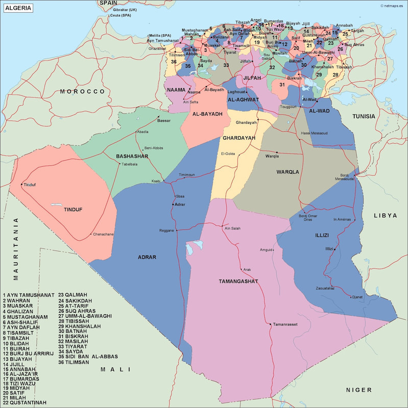
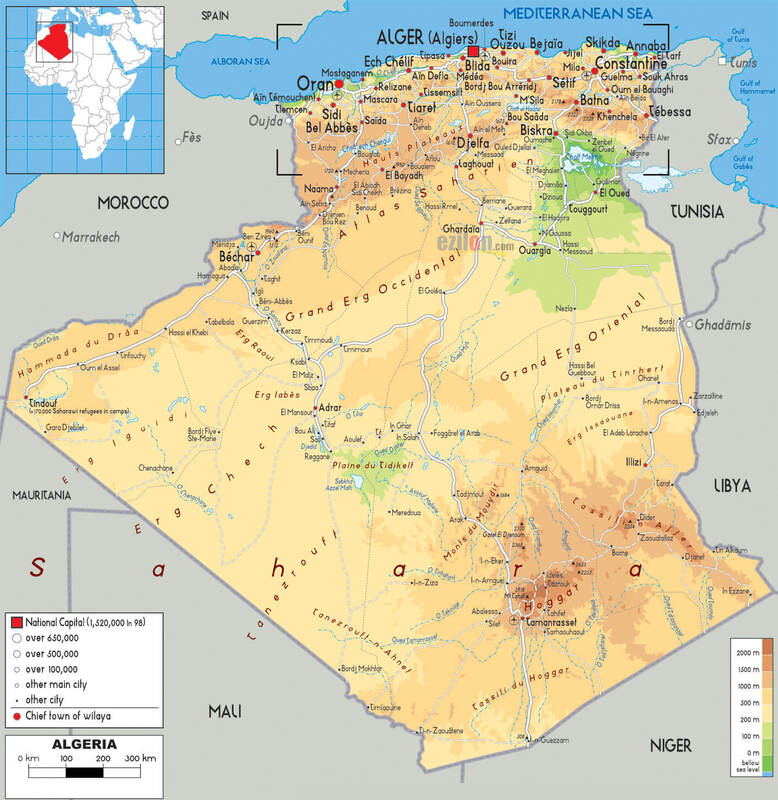
Maps of algeria
Algeria Map - Guide of the Worldalgeria political map. Vector Eps maps. Eps Illustrator Map | Vector World Maps (netmaps.net)
Algeria Map - Guide of the World\
Algeria Map - Guide of the World
Algeria Map - Guide of the World\
Algeria Map - Guide of the World
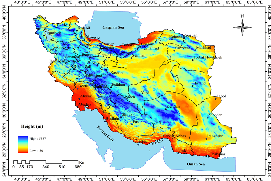
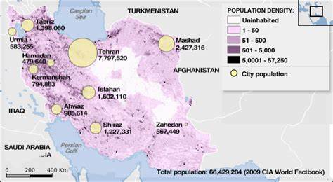
This is a level 4 analysis of the physical map of Iran. Iran is a large country in the middle east.
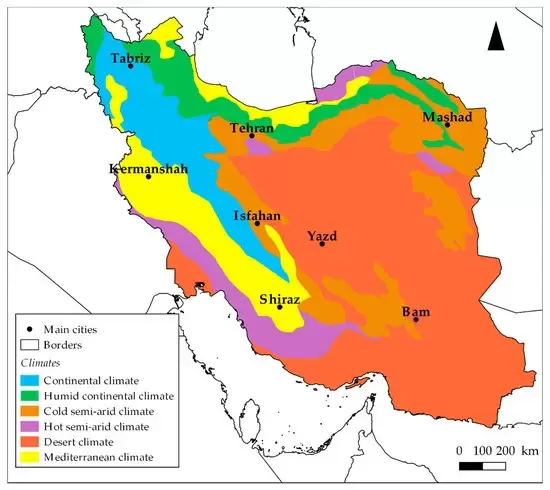
Iran is located near the equator and has a warm climate. most of the land is covered in vast desserts with forests in the north near the coast of the Caspian Sea. this is also where the population is the most dense and the location is very urban. there are also several mountains and salt lakes.
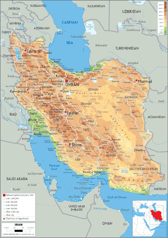
Populations and cities are often centered around coastal areas for several reasons. in Iran the coast of the Caspian Sea is useful for trading and shipping making it an economic hotspot for the country. it is also significantly colder than the deserts of Iran making it a more suitable living environment. the capital of iran is located about 65 miles away from the coast and is in a perfect location for growing crops due to the rivers coming from the coast.
these cities of Iran are utopia for its citizens due to the nice weather compared to the rest of Iran and the larger economies from the farming and maritime trade. it is similar to Seattle because of its proximity to the sea and the coast it is also similar in that it is very urban near the coast and rural everywhere else like Washington.
Iran is located near the equator and has a warm climate. most of the land is covered in vast desserts with forests in the north near the coast of the Caspian Sea. this is also where the population is the most dense and the location is very urban. there are also several mountains and salt lakes.
Populations and cities are often centered around coastal areas for several reasons. in Iran the coast of the Caspian Sea is useful for trading and shipping making it an economic hotspot for the country. it is also significantly colder than the deserts of Iran making it a more suitable living environment. the capital of iran is located about 65 miles away from the coast and is in a perfect location for growing crops due to the rivers coming from the coast.
these cities of Iran are utopia for its citizens due to the nice weather compared to the rest of Iran and the larger economies from the farming and maritime trade. it is similar to Seattle because of its proximity to the sea and the coast it is also similar in that it is very urban near the coast and rural everywhere else like Washington.
